Climate scenario
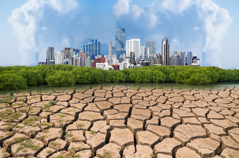
For the purpose of WaterLOUPE future water shortage risk calculations, one RCP climate scenario was selected during the workshops: the RCP8.5 scenario. This climate scenario represents a worst-case scenario in which temperature increases, and precipitation increases during the wet seasons and decreases during the dry ones. This scenario was downscaled according to the approach that was followed for the Magdalena Basin (Colombia). Based on this approach, we translated this RCP into local water availability of the sub-basins.
In the last Assessment Report of IPCC (AR5), the approach to define the scenarios has focused on a parallel development of emissions and socioeconomic scenarios. The starting points of these scenarios are radiative forcing pathways that describe an emission trajectory and concentration by the year 2100. These radiative forcing trajectories are termed “Representative Concentration Pathways” (RCPs) and are broadly described as “climate scenarios”. The RCPs can either be or not be associated with unique socioeconomic and policy assumptions. They can also result from different combinations of economic, technological, demographic, policy, and institutional futures. There are four radiative forcing scenarios which are defined depending on the total radiative forcing in year 2100 relative to 1750. Scenario 2.6 is a mitigation scenario in which the emissions peak and decline before 2100. Scenarios 4.5 and 6.0 are stabilization scenarios and scenario 8.5 is a rising scenario with very high greenhouse gas emissions. The IPCC generated a set of data based on the new climate simulations carried out with the climate model ensemble under the framework of the Coupled Model Intercomparison Project Phase 5 (CMIP5) and using the RCPs as basis.
Socio-economic scenarios
The aim of the socio-economic scenarios is to understand how both exposure and vulnerability will develop in the future. Especially for the long-term horizon, it is impossible to predict socio-economic change; therefore, instead of using a single projection, we identify multiple scenarios that enable us to deal with different ‘what-if’ outcomes. As such, it is possible to design policy that is effective in different future outcomes.
In order to derive plausible socio-economic scenarios, the narratives and quantification of key drivers is derived from different global sources. Future population projections are derived from the United Nations and the IPCC (the ‘Shared-Socioeconomic Pathways’ – SSPs). The SSPs are also used for economic growth, sub-sectoral distribution and urbanization developments and directions of key vulnerability indicators. This is combined with local information on current abstractions of irrigation, households and industries in the relevant (sub-) catchments. Based on the different narratives, the future water demand distribution over different sectors and users is identified, as well as the vulnerability per user group. The narratives also include developments of legislation and regulation that influence water management. This is combined with different climate change scenarios to understand future risk under different scenarios for the different stakeholders in the catchment area. The following paragraph describes a short storyline per SSP.
SSP1 (Sustainability) represents a sustainable world where it is easy to mitigate and adapt to climate change because of the rapid development of low-income countries, reduced inequality, rapid technology development, and a high level of awareness regarding environmental degradation. Good yield enhancing technologies for agricultural land are also incorporated.
SSP2 (Middle of the Road) represents conditions where the socio-economic trends of recent decades continue. Reductions in resource use and energy intensity are achieved at historic rates.
SSP3 (Fragmentation or Rocky road) represents conditions where it is difficult to mitigate and adapt to climate change because of extreme poverty and a rapidly growing population. There is serious degradation of the environment, and technological change in the energy sector is slow. Because of the limited coordination between regions, use of local energy resources is enhanced.
SSP4 (Inequality) represents a highly unequal world both within and across countries. Crop yields would be high in industrial farming, but low for small scale farming.
SSP5 (Conventional Development) represents a situation where it is easy to adapt owing to robust economic growth, but difficult to mitigate the effects of climate change because the energy system is dominated by fossil fuels. Agro-ecosystems are highly managed, building on strong technological progress in the agricultural sector. Land use management is generally very resource intensive including the management of water systems.
References
A new scenario framework for Climate Change Research: scenario matrix architecture (2013)
Climate adaptation Colombia. Climate data scaling and analysis of the Magdalena basin (2014)
A new scenario framework for climate change research: the concept of shared socioeconomic pathways (2013)
Building global water use scenarios (2016)